↓
 

Philadelphia Land Surveying

Local Land Surveyors in Philadelphia, PA

Philadelphia Land Surveying
(215) 585-2885
Philadelphia Land Surveying
  • Home
  • ALTA Survey
  • Boundary Surveying
  • Construction Survey
  • Drone LiDAR Mapping
  • Elevation Certificate
  • Land Surveying
  • Topographic Survey
  • About Us
  • Blog
  • Contact Us
Home 1 2 3 … 6 7 >>

Post navigation

← Older posts

Welcome to Philadelphia Land Surveying

Philadelphia Land Surveying Posted on August 18, 2017 by PhiladelphiaSurveyorApril 16, 2018

This site is intended to provide you with information on Land Surveying in the Philadelphia, PA and Philadelphia County area of Pennsylvania. If you’re looking for a Philadelphia Land Surveyor, you’ve come to the right place. If you’d rather talk to someone about your land surveying needs, please call our local number at (215) 585-2885 today. For more information, please continue to read.

land surveyingLand Surveyors are professionals who make precise measurements to determine the size and boundaries of a piece of real estate.  While this is a simplistic definition, boundary surveying is one of the most common types of surveying related to home and land owners. If you fall into the following categories, please click on the appropriate link for more information on that subject:

Philadelphia Land Surveying services:

    1. I need to know where my property corners or property lines are. (Boundary Survey)
    2. I have a loan closing or re-finance coming up on my home in a subdivision. (Lot Survey)
    3. I need a map of my property with contour lines to show elevation differences for my architect or engineer. (Topo Survey)
    4. I’ve just been told I’m in a flood zone or I’ve been told I need an elevation certificate in order to obtain flood insurance or prove I don’t need it. (Flood Survey)
    5. I’m purchasing a lot/house in a recorded subdivision. (Lot Survey – See Boundary Survey if you’re not in a subdivision.)
    6. I’m purchasing a larger tract of land, acreage, that hasn’t been subdivided in the past. (Boundary Survey)

Contact Philadelphia Land Surveying services TODAY at (215) 585-2885.

Posted in boundary surveying, elevation certificate, land surveying, land surveyor | Tagged boundary survey, land surveyor, land surveyor philadelphia tn, Philadelphia Land Surveying

Shared Walls, Alleys, and Lot Lines: Where Boundary Surveying Helps

Philadelphia Land Surveying Posted on July 9, 2026 by PhiladelphiaSurveyorJuly 4, 2026
Urban alley with closely spaced buildings reviewed for boundary surveying, shared walls, and lot line clarity.

In a packed neighborhood, ownership stops being obvious. Walls press against walls, alleys thread between buildings, and lot lines vanish under pavement and structures that have stood for generations. Boundary surveying restores order to that crowded picture, defining where one owner’s ground ends and another’s begins. On tight urban parcels, a misread edge can spark a dispute or derail a repair, so knowing exactly where the lines fall carries real weight. The survey turns a confusing tangle of shared spaces into clear, defensible limits.

Define Ownership Edges in Tight Urban Settings

When buildings and shared spaces sit inches apart, the edges of ownership blur. A survey defines those lot lines precisely, so each owner knows exactly what belongs to them. That definition brings order to a setting where the boundaries hide in plain sight.

Clear edges settle a lot of quiet uncertainty. Owners in tight quarters often assume where their ground ends, and those assumptions don’t always hold. Defining the ownership edges replaces guesswork with certainty.

Question Whether a Shared Wall Sits on the Line

A wall between two properties looks like an obvious boundary, but it isn’t always. A shared wall may straddle the line, sit entirely on one side or run slightly off from where owners assume. A survey checks the wall against the true boundary rather than taking its position for granted.

That verification matters before anyone acts on the wall. Repairs, changes or disputes involving a shared wall all depend on knowing where it truly sits. Questioning the wall’s position keeps those decisions on solid ground.

Plot Alley Connections That Affect Daily Property Use

Alleys shape how a crowded property functions day to day. Rear access, service entries, parking and maintenance all flow through these narrow spaces, and their connection to the property affects daily life. A survey plots how the alley ties to the lot, so owners understand what they rely on.

That mapping supports the routines a property depends on. Trash collection, deliveries and rear parking all need the alley to work as expected. Plotting the alley connections keeps those daily functions clear.

Identify Encroachments Before Repairs or Transfers Begin

Crowded parcels invite encroachments. A feature that crosses or crowds a property line can sit unnoticed for years until a repair or sale brings it to light. A survey identifies those encroachments early, so they surface as facts rather than surprises.

Catching them ahead of time changes the outcome. An encroachment found before a transfer or repair can be addressed calmly, while one discovered midway becomes a crisis. Identifying encroachments early keeps the process smooth.

Support Clear Decisions Among Owners, Buyers, and Neighbors

Shared urban conditions demand shared understanding. When owners, buyers and neighbors all read from the same mapped information, confusion drops and decisions get easier. A survey provides that common reference for everyone involved.

That clarity keeps relationships civil. Instead of arguing over where lines and features fall, the parties can point to measured facts. Supporting clear decisions keeps shared-space matters from turning sour.

Frequently Asked Questions

Does a shared wall always sit on the property line?

Not always. A wall may sit on the line, straddle it or fall to one side, so it should be checked through boundary surveying rather than assumed. Treating the wall as the boundary without confirming risks an error.

Can boundary surveying help with alley access disputes?

Yes. It shows the lot limits and the location of access-related features, which gives the parties a factual basis for resolving a disagreement. Mapped information tends to cool a dispute that assumptions would inflame.

Why are urban lot lines harder to see?

Walls, paving, fences and building edges can hide the true boundary, so what looks like the line often isn’t. In crowded settings, the visible features rarely match the recorded limits without a survey to sort them out.

Should boundary surveying be done before repairing a shared wall?

It helps. A survey shows where the wall sits relative to the line, so owners understand their position before work begins. Repairing a shared wall without that clarity can lead to disputes over who owns what.

Posted in boundary surveying | Tagged boundary survey

Historic Land Parcel Reconstruction Using Modern Land Surveying Verification Methods

Philadelphia Land Surveying Posted on July 2, 2026 by PhiladelphiaSurveyorJuly 2, 2026
Land surveyor recording measurements beside total station equipment to verify historic parcel boundaries using modern surveying methods.

Many older properties have lines that became unclear over the years as markers wore down and papers changed hands many times. Modern land surveying verification methods mix old records and exact field measurements to rebuild these original lines with full confidence. Handwritten deeds, lost stone markers and landmarks that vanished long ago often leave owners unsure where their land truly ends. This work does not just redraw lines to fit how people use the ground today. It follows each property back to its start so the final map honors the rights set when the land was first divided.

Rebuilding Parcel History From Original Land Records

Surveyors begin by gathering every public paper tied to the land from the earliest date they can find. They collect original government grants, hand-drawn maps, subdivision plans and every deed that passed ownership across decades or even centuries. Each paper shows how the piece was split, made larger or changed over time, and tells what the first owners meant the boundaries to be. Teams follow these changes in order so they fully understand how the property grew before they step outside to measure anything.

This step looks only at history and ignores how the land looks right now. Surveyors do not let fences, driveways or newer buildings change how they read the oldest records. They write down every direction and distance from older papers and mark spots where later versions changed words or left out important facts. This timeline becomes the base for all later work because it proves exactly what the boundary was supposed to be from the very beginning.

Translating Outdated Survey Calls Into Modern Field Measurements

Old land descriptions often use words and units that do not work with today’s tools. They may measure length in old units called chains or links, use compass directions that slowly shifted over time or tie lines to big trees, springs or dirt roads that no longer exist. Some descriptions simply follow a creek or ridge without giving exact measurements at all. These terms made perfect sense to the first surveyors but leave too much room for error when people read them today without careful conversion.

Surveyors turn every old term and reference into standard units and numbers that work with modern precision gear. They figure out how compass readings have moved since the first survey and adjust angles to match true north. For landmarks that disappeared they cross-check neighboring properties and leftover clues to place the old reference as accurately as possible on today’s measurement grid. This translation turns confusing old language into exact positions that field crews can find and measure reliably on the actual ground.

Verifying Lost or Disturbed Corners With Multiple Evidence Sources

Original corner markers almost never last a hundred years or more without damage. Farming, building, road work and shifting soil often crack, move or cover the concrete posts, stone piles and iron pins that once marked exact turning points. When these go missing surveyors never guess or set new markers at random. They collect every available clue from the site and surrounding records and weigh each fact against the others to reach the most dependable answer.

They use many separate kinds of proof to double-check their findings:

  • Broken or buried pieces of original markers found on or near the land
  • Boundary lines of all neighboring properties and their own recorded history
  • Old fences, walls or paths that local owners have respected for generations
  • Middle lines of old roads that show up on the earliest available maps
  • Measured lengths and directions that match the original deed most closely

No single item decides the final spot by itself. Surveyors look for agreement across most or all of these sources before they place any replacement corner. This method follows long-used rules that respect the original layout more than perfect math alone. It gives results that hold up during title checks or legal questions because every choice rests on facts that anyone can see and confirm.

Resolving Gaps and Overlaps Created by Old Parcel Descriptions

When people copied descriptions by hand or split large pieces into smaller lots over many years small mistakes slipped in almost every time. A length written as 320 feet might become 300 feet in the next deed or a direction might turn slightly with each new copy. Over generations these errors build up until the shape on paper no longer fits cleanly onto the real ground. The result is often narrow strips that no one claims or sections where two or more deeds say the same ground belongs to them.

Modern surveying puts all these conflicting descriptions onto one accurate base map so problems become clear right away. Teams measure the full area of each version and find exactly where records double up or leave spaces unclaimed. They follow each mistake back to the paper that first carried the error and pick the most logical fix that still honors the original meaning. This work does not rewrite history. It sorts out tangled records so every property fits together without gaps or double claims on the ground.

Creating a Modern Survey Record for Future Ownership Clarity

Once the team answers all open questions they make a complete official survey that explains every step of the work. The map shows the final boundary, all found or replaced markers, the location of buildings and short notes telling how each decision was reached. It also lists every record and field measurement used so future surveyors, lawyers or title workers can follow the work without starting the whole process over. This record works easily with current mapping systems and official government land files.

Owners use this paper to settle questions with neighbors, complete property sales, update title records or divide land among family members. Banks and insurance companies also accept it as solid proof of where the property sits and what it includes. Unlike the old conflicting records that caused confusion in the first place, this new document uses plain words, standard measurements and clear drawings that anyone can follow without special training.

The best part of this work is that it stops the same confusion from happening again. Future owners will not need to repeat all the historic research because the official survey already organizes all the facts into one trusted file. It protects the original rights of the land while giving future generations a clear stable reference they can count on.

Frequently Asked Questions

What is historic land parcel reconstruction?

It is the process of reviewing old records, field evidence, and modern survey measurements to understand how a parcel was originally created and where it fits today.

Why do historic parcels need special survey verification?

Older parcels may rely on outdated descriptions, missing monuments, changed roads, or landmarks that no longer exist, making modern verification important.

Can surveyors work with old deeds and plats?

Yes. Surveyors can compare old deeds, plats, adjoining records, and physical evidence to help reconstruct the parcel’s location and boundary history.

What happens if original property corners are missing?

Surveyors review multiple evidence sources, such as nearby monuments, adjoining parcel records, occupation lines, and measured field data to support reconstruction.

How does parcel reconstruction help property owners?

It gives owners a clearer modern survey record that can support title review, future sales, estate matters, land planning, or boundary clarification.

Posted in land surveying | Tagged Land Surveying

How Construction Surveys Keep Multi-Phase Projects Moving in the Right Direction

Philadelphia Land Surveying Posted on June 25, 2026 by PhiladelphiaSurveyorJune 21, 2026
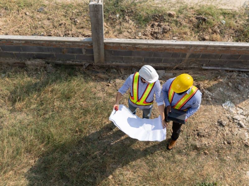
Construction professionals reviewing site plans during a construction survey for ongoing development work

Large developments rarely get built in one continuous push. A construction survey plays a key role at almost every stage of these phased projects. It gives each new phase a way to connect back to the work that came before it. Without that connection, even small shifts can cause real problems down the line. For developers managing a project across years rather than months, that kind of continuity matters.

Major Projects Rarely Reach the Finish Line in One Step

Large developments rarely move forward in one single push. Most get built in phases, with different parts of the project moving on their own schedule. Infrastructure might go in first, followed by buildings, then utilities, then site improvements.

A master-planned community might start with roads and underground utilities. Buildings come next, often years apart from each other. Some phases wait on funding, while others wait on permits or market demand.

This kind of staged approach makes sense for big projects. It spreads out cost and risk over time. But it also means a project’s pieces have to connect well even when they’re built months or years apart.

Each Phase Builds on the Accuracy of the One Before It

Early work on a project sets reference points for everything that comes after it. A road built in phase one becomes the reference line for utilities added in phase two. A foundation poured early can affect how later buildings line up nearby.

Small mistakes in early phases don’t always show up right away. A line that’s off by a few inches might not matter much on its own. But that same small gap can grow once three or four more phases get built around it.

Construction surveys keep this kind of drift from happening. Each new phase gets checked against the same accurate reference points used in earlier work. That consistency keeps small errors from turning into expensive problems years down the road.

Different Contractors Enter the Project at Different Times

A single phased project often passes through many different hands. Grading crews might finish their work months before utility contractors show up. Concrete teams, structural contractors, and paving crews often follow even later.

None of these teams are usually on site at the same time. A paving crew working a year after the grading crew left has no easy way to confirm the original layout just by looking at the ground. They need something more reliable than memory or rough notes.

Construction surveys give every contractor the same accurate starting point, no matter when they show up. That shared reference makes it possible for different trades to coordinate well even though they never overlap on site. Nobody has to guess at what an earlier crew left behind.

Construction Surveys Provide Continuity When Timelines Change

Few large projects move forward exactly on schedule. Weather delays, permit approvals, funding gaps, and material shortages can all interrupt a project’s sequence. Any one of these can push a phase back by weeks or even months.

When work pauses for months, the risk of losing track of earlier improvements goes up. A construction survey keeps that risk low. It gives crews a way to pick up exactly where the project left off, even after a long break.

This matters most on projects that span years rather than weeks. A survey done early in the process still holds its value long after the work has stopped and started again more than once. Future phases reconnect to earlier work without confusion, no matter how long the gap was.

Long-Term Success Depends on Keeping Every Phase Connected

Phased developments often continue for years past their original start date. Priorities can shift as a project moves forward. A development plan written in year one might look different by year five, and several parts of a long project depend on staying connected through all of that change.

  • Future expansions
  • Later building phases
  • Infrastructure upgrades
  • Ongoing site improvements

Construction surveys give every one of these later additions a reliable framework to build from. Each new phase can connect cleanly to the work that came before, even if priorities or designs shifted along the way. That kind of reliability protects the project as a whole. Owners who keep accurate survey records through every phase end up with a development that holds together for years.

Frequently Asked Questions

Why are many construction projects completed in phases?

Large developments often need separate schedules for infrastructure, buildings, and utilities. Building everything in phases makes it easier to manage funding, permits, and construction timing. This approach is common on big developments that take years to finish.

How do Construction Surveys support multi-phase projects?

Construction surveys set accurate reference points that stay consistent through every stage of a project. Later phases use those same points to line up correctly with earlier work. That consistency helps avoid costly mistakes as a project grows.

Why is continuity important during phased construction?

Work completed early in a project affects every phase that follows it. A small gap in one phase can grow once later phases build around it. Maintaining alignment from the start helps avoid conflicts and delays.

Can Construction Surveys help when projects experience delays?

Yes. Construction surveys provide dependable reference information that doesn’t lose value during a pause. Crews can pick up an interrupted project and reconnect to earlier work with confidence. That accuracy holds up no matter how long the delay lasts.

Who relies on Construction Surveys during phased developments?

Developers, builders, contractors, engineers, and property owners all rely on accurate survey information throughout a project. Each group uses it at a different stage, from early grading to final paving. That shared accuracy keeps everyone working from the same reliable picture.

Posted in construction | Tagged construction survey

Post navigation

← Older posts
Get Quote Button
© Boxer Survey USA
Philadelphia Land Surveying

Philadelphia, Pennsylvania
Phone: (215) 585-2885

Privacy Policy | Terms of Use

Web Development and SEO by:
AuburnBusiness.com, LLC

The owner of this website, Boxer Survey USA, provides coordination of professional land surveying and engineering services in all 50 states. The professional surveying and engineering services provided to you will be conducted by fully licensed professionals in your state.

↑